Burn Zone Information
All the burn zone maps have been moved from the main status page to here. There are maps and descriptions for your convenience.
Burn Zones
County Maps are located at the bottom of this page.
Description of each zone boundary
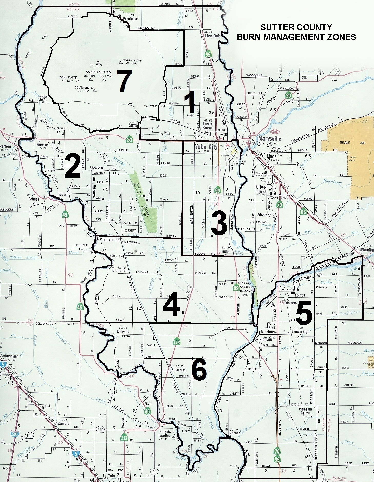
Sutter County
- Zone 1: Bordered by the Butte County line to the north; the Feather River to the east; Highway 20 to the south; and on the west by the Sutter Buttes Area (See Zone 7) and Almond Orchard Road.
- Zone 2: Bordered by the Butte County line to the north; Almond Orchard Road, the Sutter Buttes Area, Acacia Avenue, and Township Road to the east; to the south by O'Banion Road and the Tisdale Bypass; and the Sacramento River to the west.
- Zone 3: Bordered by Highway 20 to the north; the Feather River to the east; Tudor Road (Highway 113) to the south; and Township Road to the west.
- Zone 4: Bordered by the Tisdale Bypass, O'Banion Road, and Highway 113 to the north; Township Road and the Feather River to the east; from the confluence of the Bear River and Feather River along Subaco Road to the Yolo County Line to the south; and the Sacramento River to the west.
- Zone 5: Bordered by the Bear River to the north; the Placer County line to the east; the Sacramento County line to the south; and the Feather River to the west.
- Zone 6: Bordered to the north by Subaco Road at the Yolo County Line to the confluence of the Bear River and Feather River; the Feather River to the east; and the Sacramento River to the south and west.
- Zone 7: The Sutter Buttes Area lies inside the following: West Butte Road, North Butte Road, Powell Road, Pennington Road, Township Road, Clark Road, East Butte Road, Ahlf Road, Mallott Road, Butte House Road, Oak Street, Butte Avenue, Griffith Lane, and Walnut Avenue to South Butte Road.
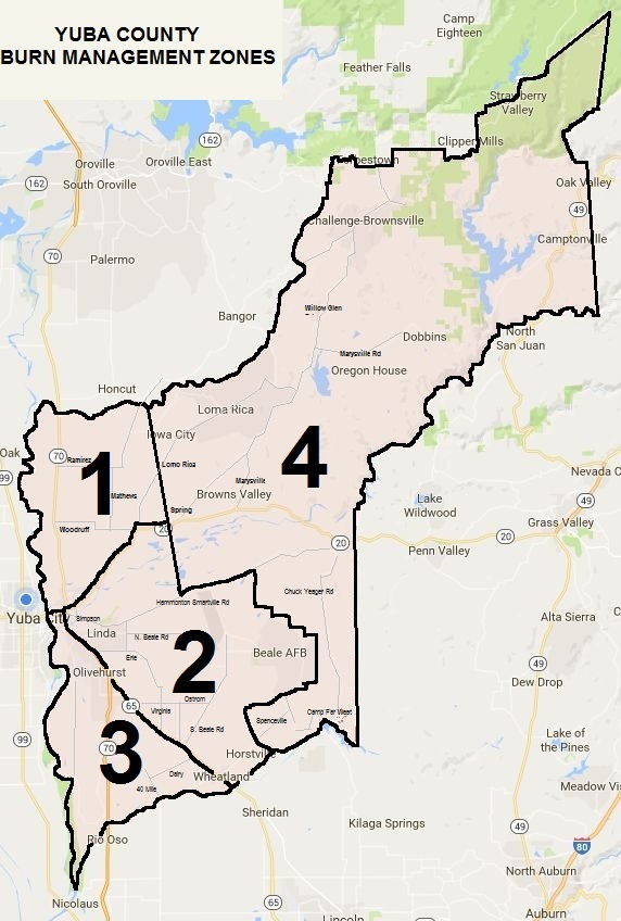
Yuba County
- Zone 1: Bordered by the Butte County line to the north; by the State Responsibility Area (SRA) to the east; Highway 20 to the south; and the Feather River to the west.
- Zone 2: Bordered by Highway 20 to the north; the SRA to the east; the Bear River to the south; and Highway 65 to the west.
- Zone 3: Bordered by Highway 20 to the north; Highway 65 to the east; the Bear River to the south; and the Feather River to the west.
- Zone 4: The State Responsibility Area. For more information on the SRA, Click Here